The penghu islands, or also known as the Pescadore islands, is an island group just west of Taiwan in the Taiwanese strait.
It plays quite an important role in the history of Taiwan, as at first the Dutch East India Company in 1622 built a trade settlement on the pescadores instead of the Island of Formosa. Due to hostilities with Ming Dynastie China in 1624 both parties agreed on that the Dutch would destroy their fort on Penghu island but in return could build a trade settlement on Formosa. As that island was considered outside of China’s territory.
The Dutch moved to Taiwan and built trade settlement protected by a fort, called Fort Zeelandia. The local governor, governing the day to day activities at the trade post kept a Day-to-day register in order to inform the company headquarters back home.
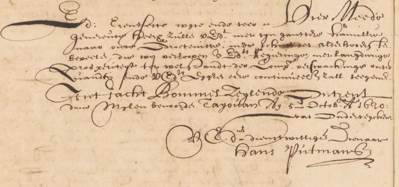
In the day-to-day registers of Fort Zeelandia we can find a description by the dutch Governer Hans Putmans of his travel to the Pehou (also Penghu Island) in December of the year 1629.
I would like to share with you that description:

Description of the Penghu islands by Hans Putmans
December 5, 1629
The wind still blows hard from the north, so hard we could not sail yet.
December 6, 1629
The wind has decreased, we set sail on the yacht [1] “Domburch” towards Pehou. On December 7th we docked in the eastern bay of the island Pehou from there we could haul rocks and stones aboard for building the fort.[2]
December 8th, 1629
Together with Governor Putmans, Skipper Jan Isebrantse, Merchant Paulus Traudenius and Secretary Dirck Jansse, accompanied by 8 soldiers and sailors we went for a walk accros the whole island of Pehou.
After half an hour of walking we arrived at the ruins of a Chinese Fortress. The fort was built on top of a mountain [3] and built of propper stones which were mined closeby from the same location.
From there towards the west, about 1.5 miles [4]. We arrived at another fort, also abandoned. The houses inside were razed to the ground.; The fort itself was large: about 340 steps. The wall had the height of one and a half person. And was one person thick. It did not had any parapet and no bastions. I was built flat in the field.
From the fort, about a 1/4 of an hour walk. Just next to the bay, there stood a small Church where their gods were worshipped [5]. A lamp was burning. Here the person who was supervising the church cooked some pattates [6] for us people.
From here, about half an hour walk, we arrived at a corner of the island. There we found 20 trenches, with eight Dutch stucken [7] , one Chinese stuck and three bassen. [8]. They all were decayed and rusty due to the weather. Also here we didnt find any traces of people and everything looked so lost as if there hadn’t been people for many years.
From here, right across the water, on the other side was our abandoned fort. Built by Commander Cornelisz Reyersz. The both places could shoot at eachother, the one located southwest and the other northeast from another both at equal height.
We did not find a single tree on the island, it has sugarcane, grows sweet potatoes and confirmed by some has wild pigs although we did not see them; it is populated at the seashore, however we did not find many people and the ones we found were poor fishermen. The land is mostly rocky with empty flat mountains. Some chinese sailors which joined us from Teyouan, told us, the Forts we told of before were populated 6 months a year and were deserted the other 6 months. However they looked as if no one lived had there for over five decades so much the forts looked like ruines and were overgrown by grass.
December 9th, 1629
We went to our abandoned fort to see it for ourselves. It was located, only a mile from the bay at which our ships were anchored and not dangerous; it was completely razed to the ground. Just as the chinese one of yesterday the fort was located at the corner of the island on top of a mountain. It was squared and had a circumference of about 160 passes with four pointy bastions carved from the mountain. It was located such, that it looked inpregnamble to human judgement.
At the front side of the fort, near the bottom we found 17 Dutch cannons (stucken [7]) shooting size: 5, 6, 9, 12, 14 irons. en 14 bassen. Most of them decayed by weather influences. From here you could see straight over the water into the Chinese trenches we visited yesterday. Standing at one bastion of the fort we could oversee all of the island.
Below the fort stood some chinese dwellings. Which were inhabited by people since our fort was abandoned but we found no-one.
While anchored here with our ships we loaded our ships with rocks and stones for our fortification in Teyouan.
December 11th, 1629
We left the pescidores island and arrived at the mouth of the Chincheo river on december 12th.
[1] A yacht was not a fixed ship type but in general a small, fast, agile ship used for local trade was called a yacht. An example of a replica of a typical yacht of VOC era you can find here.
[2] Fort zeelandia, Formosa
[3] probably Tai-wu hill. (seems just like current day the dutch called hills sometimes mountains back then also ;))
[4] probably a ‘duitse mijl’ corresponding to 7,407 kilometer
[5] Temple of Mazu, still standing on this very day. In the city centrum of Ma-kung. Most likely the oldest temple of Mazu in Taiwan.
[6] edible root brought over from the americas, Portugees batata, English sweet potato. plural: patattasen. dutch: zoete aardappel.
[7] Stucken: Dutch cannons, often used on ships.
[8] Bassen: small ship cannons. small bronze cannon without a gun cariage.
Historical map of the Pescadores around 1622

Sources:
R.G.P. 195: Dagregisters of Taiwan I (1629-1641)
Atlas of Mutual Heritage
Huygens Institute
Nationaal Archief
1 thought on “A year 1629 description of the of the Penghu islands ( 澎湖群島 )”