Geography of Taiwan – Republic Of China (R.O.C).
Table of Contents
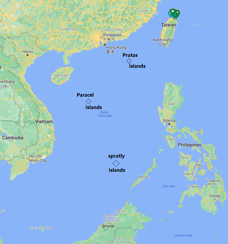
Where is Taiwan?
Taiwan, or its official name Republic of China, is a country which lies in East Asia. It is totally surrounded by water. In total it consists of about 168 islands but the main island takes up most of the land area. Closest country is Japan with some of islands which are part of the Okinawa prefecture. Followed by mainland China. Further south of Taiwan lie the Philippines.
Which countries are nearby Taiwan?
Following the clock clockwise, the countries which surround Taiwan are:
- Hong kong,
- Mainland China,
- South Korea,
- Japan,
- The Philippines
- Vietnam.
Which waters surround Taiwan?
Taiwan is surround by water on all sides. Those are:
- Taiwan strait
- Luzon strait
- Philippine sea
- East China Sea
- South China sea
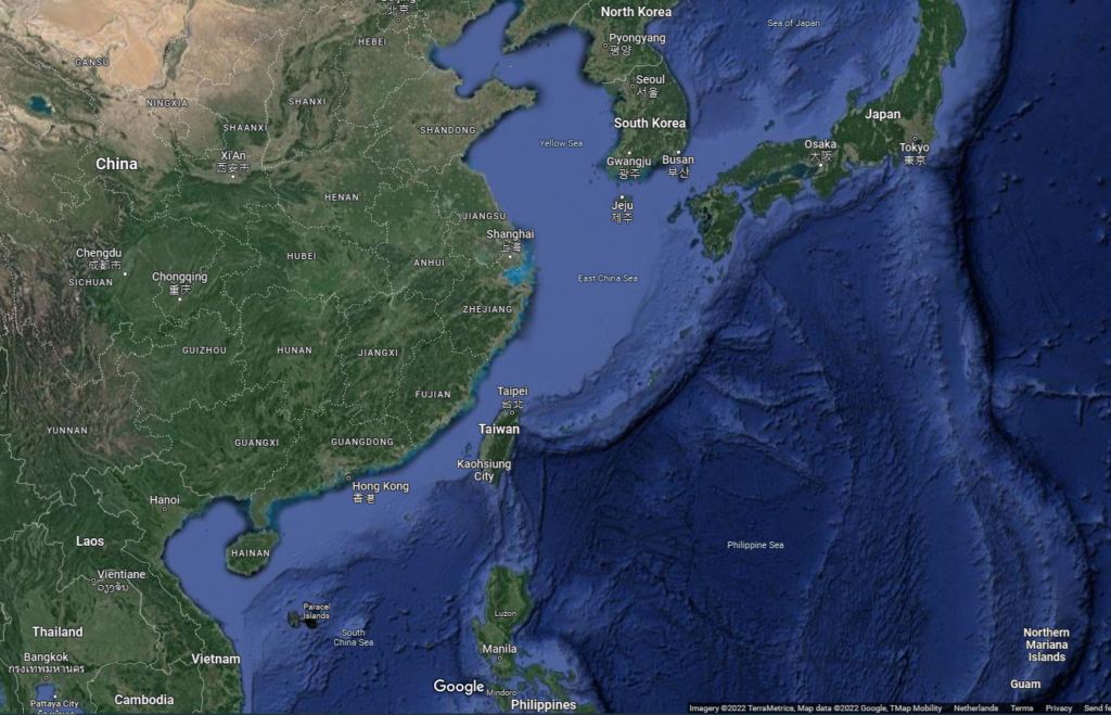
Taiwan strait
Between Taiwan and Mainland China (PRC – Peoples Republic of China) lies the Taiwan strait an International water. At its Narrowst its 130km (81 miles) wide, at its widest about 180km (112miles).
The Strait is on average 150m deep which is not too deep. Several Islands also lie in the strait. Because it is not too deep currently Taiwan is developing major windmill farms as to increase their renewable power.
The Taiwan strait is a major shipping route and both Taiwan and Mainland China has large ports.
.jpg)
The Taiwan strait is an important and popular shipping route.
Picture by 2005emsaguindan, CC BY-SA 4.0, via Wikimedia Commons
Luzon strait
Between Taiwan and the Philippines lies the Luzon Strait. It connects the Philippine Sea to the South Chinese Sea just southwest of Taiwan.
The Luzon Strait is about 250 km (160 miles) wide but in the contrary to the Taiwan strait It is very deep. In some parts it reaches a depth of about 3500 to 4000 Meter!
This strait is also an important shipping and route. Especially ships from the Americas towards the larger East Asian harbours.
Philippine sea
In the East of Taiwan lies the Philippine Sea, It is part of the Western Pacific Ocean. And has an area of approx. 5 million square kilometers. It has a diverse marine biodiversity with many endemic fish species. It is also known as a breeding and feeding ground of the whale shark.
It is also an important fishing ground for the Philippines.

The philippine sea
Aplaice, CC BY-SA 4.0, via Wikimedia Commons
The Phillipine sea came in the news recently when the U.S.S. Samuel B Roberts, a WWII destroyer class sunk in the Battle of Samar, was found by explorer Victor Vescove of Caladan Oceanic Expeditions together with EYOS Expeditions.
It was found around 6985 meters (22,916 ft) underwater. The deepest shipwreck ever found!
East- & South China sea
Just north of Taiwan lies the East China Sea. It is located between Mainland China, South Korea, Japan and Taiwan. The largest Chinese river, the Yangthze River flows directly into the East China Sea.
As the name suggest southwest of Taiwan lies the South Chinese sea. (ofcourse it is derived from being south of Mainland China). The south Chinese sea has many small islands and archipelago’s. And even these islands are very small and mostly uninhabited, several countries claim sovereignty over them. Territorial claims are mainly because of the natural resources and fishing grounds.
The Taiwan archipelago
The Taiwanese archipels consists not only of the main island but also out of many smaller islands (about 168). Some important ones I would like to discuss below.
Kinmen and Matsu
When the Chinese Nationalist Party (KMT) retreated to Taiwan following the Chinese Civil War they kept some of the small islands near Mainland China’s Coastline.
Two of the islands which are closest to Mainland China and most well known are Kinmen and Matsu.
Kinmen
Kinmen lies aprox. 10 kilometer offshore from the Chinese city of Xiamen.
It is most well known for beying shelled by the PLA during the first and Second Taiwan Strait crises (1954-55 and 1958) however the KMT defended.
Since then luckily relations have improved. Now Kinmen is a tourist place for both Mainland China as well as Taiwanese. Tourist attractions are military Museums, Natural parks and historical buildings.

location of Kinmen County
image by TUBS, CC BY-SA 3.0, via Wikimedia Commons
Matsu islands
The Matsu islands are located more North, aproximate 20 kilometers from Mainland China and 190 Kilometers from Keelung.
Matsu island named after the Sea goddes Matsu. As it was beliefed her deathplace as a human. A temple is build dedicated to the goddess.
Some islands are a part of the Matsu islands Bird Sanctuary home to some endangered bird species.

image by Luuva, CC BY-SA 3.0, via Wikimedia Commons
Penghu islands
Penghu, also called the pescadores from its portugese name: “the fishermen islands” has a rich history. Already during the Song Dynasty (9th and 10th century) Han-Chinese fishermen lived on the islands. Later the Dutch, Ming and Qing dynasty all had small settlements.
The island group lies about 50 kilometer west of Chiayi county, Taiwan.
Total area of the Penghu islands are about 141 km2. Population is around one hundred thousand and the largest city on the island is called Magon City.
The penghu islands are quite popular for tourists. In 2018 about 1.8 million people visited the island. Some tourist attractions are:
- Magong, city central street
- Penghu Tianhou Temple, dedicated to the sea diety Mazu
- Xiyu east and west Fort
- Fenggui and Whale Cave
- South Penghu Marine National Park

Penghu County geography
image by Taiwan Junior, CC BY-SA 3.0, via Wikimedia Commons
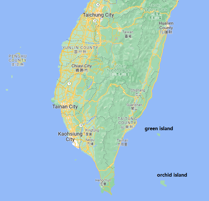
Orchid and Green island
Just south-east of Taiwan are two small islands. Closest one to the coast is Green island. A littlebit further away is Orchid island.
Green island
Green island, or in Native language: Sanasai, is a small Volcanic island 33 kilometers from the coast of Taiwan. It size is about 15 square kilometers. Current day it is inhabited by around two thousand people and its a popular tourist destination with regular ferry lines going between Taitung city and Green island .
Especially recreational diving is popular with many dive sites and reefs around the island. Other tourist attractions on the island are:
- Sika deer ecological park
- Ludao Lighthouse
- Zhaori Hot spring
Orchid island
Orchid island (on some maps also reffered to as Tabaco), or in Native language: Pongso no Tao, Ma’ataw or Irala. is a 45 square kilometer island with about 5 thousand inhabitants. Its a volcanic island and has 8 mountains of about 500m tall.
The climate is tropical with plenty of rainfall during the year. This in combination with the distance from the mainland results in many endemic plant species unique to this island.
Orchid island is now famous for its coral reefs which surround the island. Green sea turtles also nest on the island. Also whales migrate pass the island and are regularly seen.
Tourist attractions on Orchid island:
- Lanyu Flying fish cultural Museum
- local flora and fauna
- coral reefs
- Lanyue lighthouse
Travel from and to the island can be done both by airplane from Taitung Airport or by ferry during the year from Taitung city harbor and in summer from Kenting.
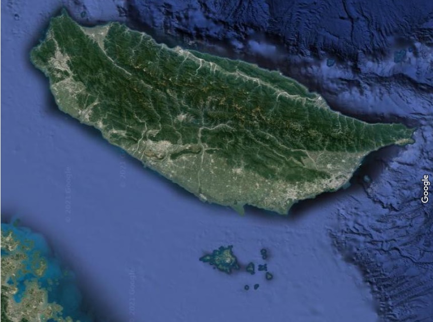
Pratas island (Dongsha atoll)
Pratas island is an island part of the Dongsha Atoll. Its located about 426km southwest from Kaohsiung, Taiwan and about 320km southeast of Hongkong.
Pratas island has no permanent inhabitants. There is however a small runway, a central plaza, a library and some military buildings. Most people who go there are researchers, military or fishermen.
The area around the island is quite shallow and has many reefs and coral. It is very important for the marine life. Since January 2017 the government of Taiwan has made the Pratas atoll part of the Dongsha Atoll National park. The very first Taiwanese marine National park!

The circular Pratas island and Nature preserve
NASA, Public domain, via Wikimedia Commons
Disputed islands: Paracel and spratly islands
More far away from Taiwan, in the South China sea are the Paracel islands and the spratly islands.
Both island groups are claimed by several countries They have high economic value as there are good fishing grounds and there is the potential of oil and gas reserves. Many reefs are surrounding the islands.
Although there are many claims the paracel islands are de facto controlled by mainland china. In recent years they have build mulitple outposts and small harbors.
The spratly islands consist of about 14 islands and are all occupied by several countries which have build military structures.. Taiwan has control of one of the largest island called Taiping island, which is about 6 ha.
Again rich fishing grounds and possible oil and gas reserves are motivation for the claims.